


Blackstone Precinct 3, Worcester County, Massachusetts
About
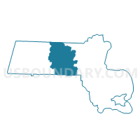
Outline

Summary
| Unique Area Identifier | 595603 |
| Name | Blackstone Precinct 3 |
| County | Worcester County |
| State | Massachusetts |
| Area (square miles) | 7.07 |
| Land Area (square miles) | 6.96 |
| Water Area (square miles) | 0.11 |
| % of Land Area | 98.51 |
| % of Water Area | 1.49 |
| Latitude of the Internal Point | 42.04576460 |
| Longtitude of the Internal Point | -71.53951260 |
Maps


Graphs
Select a template below for downloading or customizing gragh for Blackstone Precinct 3, Worcester County, Massachusetts


Neighbors
Neighoring Voting District (by Name) Neighboring Voting District on the Map
- Bellingham Precinct 3, Norfolk County, MA
- Bellingham Precinct 4, Norfolk County, MA
- Blackstone Precinct 1, Worcester County, MA
- Blackstone Precinct 2, Worcester County, MA
- Mendon Precinct 1, Worcester County, MA
- Millville Precinct 1, Worcester County, MA
Top 10 Neighboring County Subdivision (by Population) Neighboring County Subdivision on the Map
- Bellingham town, Norfolk County, MA (16,332)
- North Smithfield town, Providence County, RI (11,967)
- Blackstone town, Worcester County, MA (9,026)
- Mendon town, Worcester County, MA (5,839)
- Millville town, Worcester County, MA (3,190)
Top 10 Neighboring Unified School District (by Population) Neighboring Unified School District on the Map
- Bellingham School District, MA (16,332)
- Mendon-Upton School District, MA (13,381)
- Blackstone-Millville School District, MA (12,216)
- North Smithfield School District, RI (11,967)
Top 10 Neighboring State Legislative District Lower Chamber (by Population) Neighboring State Legislative District Lower Chamber on the Map
- Eighteenth Worcester District, MA (44,397)
- Tenth Worcester District, MA (39,749)
- State House District 48, RI (14,714)
Top 10 Neighboring State Legislative District Upper Chamber (by Population) Neighboring State Legislative District Upper Chamber on the Map
- Worcester & Norfolk District, MA (173,480)
- State Senate District 23, RI (28,574)
- State Senate District 21, RI (24,750)
Top 10 Neighboring 111th Congressional District (by Population) Neighboring 111th Congressional District on the Map
Top 10 Neighboring Census Tract (by Population) Neighboring Census Tract on the Map
- Census Tract 4431.02, Norfolk County, MA (8,694)
- Census Tract 7461, Worcester County, MA (5,839)
- Census Tract 7471.01, Worcester County, MA (5,110)
- Census Tract 128.01, Providence County, RI (4,800)
- Census Tract 7471.02, Worcester County, MA (3,916)
- Census Tract 7481, Worcester County, MA (3,190)